A Tour of the English Lakes
INTRODUCTION
CONTENTS
MAP
Introduction and Map
Pen, Paint and Pixel Exhibition
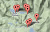
Map of All Locations
Find Locations Near Me
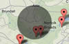
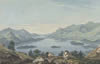
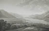
Ullswater
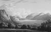
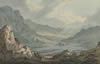
U1. View from the upper end of Ullswater
U2. Across the lake to Patterdale
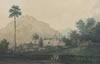
U3. The 'Palace of Patterdale'
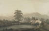
U4. Watermillock looking south
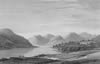
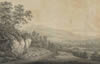
U5. The lower reach of Ullswater
U6. Ullswater from Pooley Bridge
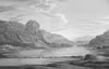
Derwentwater
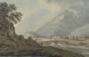
D1. View over Keswick to Skiddaw
D2. North entrance to Keswick
D3. Derwentwater looking south
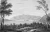
D4. View of Skiddaw down Derwentwater
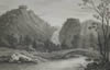
D5. Looking south to Lodore Falls
D6. View over Derwentwater to Bassenthwaite Lake
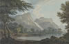
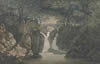
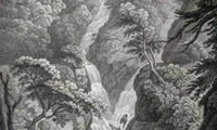
D7. Lodore Falls
D8. Derwentwater and Skiddaw from Lodore
D9. Looking towards Grange in Borrowdale
Bassenthwaite Lake
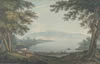
B1. Bassenthwaite Lake from the North
Thirlmere
T1. View looking north from Six-mile-stone
T2. Looking north-west down Thirlmere
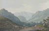
Grasmere and Rydal Water
G1. Looking across Grasmere to Helm Crag
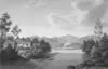
G2. Rydal Water
G3. Lower Waterfall, Rydal
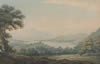
G4. Looking south towards Windermere
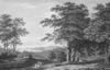
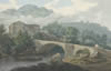
G5. Rydal Bridge
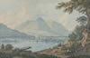
Windermere
W1. Stock-Gill (Ghyll) Force, Ambleside
W2. The road from Clappergate to Ambleside
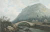
W3. Brathay Bridge, near Ambleside
W4. Windermere from above Rayrigg
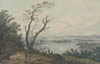
W5. Windermere from the West Shore
W6. Windermere from Gill Head
top
Published in partnership with the
Wordsworth Trust
. All content is subject to copyright.
start